Posted by & filed under Featured.

The Portal to Texas History has recently announced the call for submissions for its most recent round of the Rescuing Texas History program. Rescuing Texas History 2018 is the eleventh year of the program, which has brought to light over 45,000 items from 225 partnerships. Since the beginning of the program there have been over 6 million uses of materials hosted on the Portal to Texas History that were received in response to past call for submissions.

Now it is your turn.

Each project selected will be provided with up to $1,000 of digitization services to libraries, archives, museums, historical societies, and other groups (including individuals) that house historical materials. All materials accepted will be scanned at UNT Libraries and hosted on The Portal to Texas History. Deadline for receipt of applications is August 6, 2018.

For more information and to download the application: Rescuing Texas History Mini-Grant

Posted by & filed under Featured.

We get a lot of great feedback in the Portal, many containing anecdotes about the subjects of photos, postcards, and other images.  Oftentimes users recognize the location of an image on the Portal—be it a favorite childhood park, a mile marker passed on the daily commute, a shop downtown, or a farm belonging to some long distant relation. Sometimes places stand the test of time unchanged, become a bit weathered, or slowly fade into the background of a growing metropolis. More often than not, the subject of an image hasn’t existed for decades and the location lives on only in memory.

By the numbers

Of the 1 million + items in The Portal to Texas History, about 300,000 are historic photographs, maps, postcards, and videos and though we try, we aren’t always sure what exactly the subject is, or where it’s located. Through the hard work of our partners and staffers, we’ve been able to associate about 95% of our images with generalized geographic location names like counties and cities.  But, when it comes to knowing exact locations, we fall short, having precise locations for only about 40% of these items.

We’ve got plans for some exciting new mapping interfaces including ways to search and view items based on location, but in order to do so, and to make it as effective as possible, we need to improve our data, and we think you can help us bring that 40%, way, way up.  How? Because you know your community’s history and geography best of all and we’ve built a tool that will easily let you share that knowledge with us.

All about places – or why we need help

Location data in the Portal takes a few forms: place names, place points, and place boxes. For any location information we have about an item, we map it on a Google Map towards the bottom of an object’s ‘about’ page.  A big blue “Mapped” button towards the top of an item’s overview page tells you if we have some kind of geographic information on that item.

Place names are the most generalized type of geographic information we have, and look like: “United States – Texas – Tarrant County – Fort Worth” or “United States – Texas – Brewster County.” These locations are drawn from a large controlled list maintained in our system, and while many people could hazard a guess at where Fort Worth is, not everyone can locate a county, let alone towns like Marathon, Cushing, or so many other rural communities represented in the Portal.

Map of Texas, City of Terlingua is marked. Figure 1. Map of Texas. Terlingua is marked.


Place names, we’ve found, can be pretty helpful, but their lack of specificity put real limitations on locating items sometimes. If the best we’ve been able to ascertain about an old ruined building is that it is/was in Presidio County, well, that’s like hunting for a needle in a 3800 square mile haystack. And that’s where place points and boxes come in

The really important part

Place Points are markers on our maps that have been specifically pinpointed to a latitude/longitude by a staff person or volunteer and is the data we hope that you can help us with most because we are pretty sure a lot of you know where these things are, at least much better than we do.

When we add place point markers to the Portal, we use an embedded Google Map in our editor to record data to six decimal points (ex 29.317652, -98.450081), which gives us a specificity for the object of less than a foot. In practice we don’t actually expect our data here to be that perfect, but place points obviously have their advantages, allowing us to update maps so that they reflect the real location of a place or structure.

Similarly, place boxes are another way of indicating location data, but here in cases where the subject of the image is much broader. Typically we only use these on maps and aerial photos, and again, on the back end we have a tool that simply draws a square/rectangle onto a Google Map and we generate the coordinates from there.

And now you can help us by adding them with simple drawing tools on the map we present on most all overview pages! Doing so is fun and pretty much a breeze if you know where something is, taking less than a minute if you know a location really well.

So, how do I get started?

Whenever you visit the Portal from now on, you might see the ‘Recognize a Place?’ prompt on the ‘Mapped’ button near the top of item overview pages.  This appears when we don’t have coordinates on record, and need help identifying them. (Note: free-standing “images” only – photos, maps, postcards, etc. Not images in newspapers, books, etc.)

Screenshot of Portal. Popover visible in lower-right corner. Figure 2. Screenshot of Portal. Popover visible in lower-right corner.


Similarly, if you are looking through search results or browsing a collection, you might notice some items have a small globe icon and others don’t.  The globe indicates we know where the image is/was, its absence means we don’t.

 Search Results. One item has coordinates. Figure 3. Search Results. One item has coordinates.


Clicking “improve our maps” or scrolling through to the “where” section of a record will take you to the embedded google map at the bottom of the page.  From there you can zoom in, pan around, switch to satellite view, or even street view in some cases to find the item on a map.


View of new mapping tool with place point marker set. Figure 4. View of new mapping tool with place point marker set.


Once located, you can use the provided drawing tools (a marker and a rectangle in the lower left corner) and simply drop a pin or drag a box onto the map. The map will figure out the latitude and longitude for you and display helpful information in an info bubble.  After dragging around a bit, if you are satisfied, you can submit your coordinates along with any additional context (how you know this info is helpful!) through our contact form. The Coordinates will be neatly copied and formatted for you in the form we need.  After submission, we may take a bit of time to verify your coordinates, so don’t expect them to go up immediately, but we promise, your help is so greatly appreciated.

Curious if this is really helpful?

Here are a couple of examples that show what others like you have accomplished in less than a week, using this feature:

  • Here’s a building someone found photographed in the Portal and provided coordinates for. Here it is today. The building remains the same, but the city grew up around it.
  • This structure was pointed out to be the same as this one, which today can be mapped to about here (the structure would have been where the ‘PowerHouse Spring’ building now stands).
  • This “Bird’s eye view of Austin” is a wonderful historical view of the state’s capital city; a user pointed out that it was probably taken from atop the Capitol building facing southwest, with The Governor’s Mansion and St. Mary’s Cathedral visible in the distance. Our original record included none of those details and will be updated significantly as a result of the submission.


three images on textured background with text

Posted by & filed under Featured, Research Fellowships.

The University of North Texas Libraries invite applications for the 2018 Research Fellowships in UNT Special Collections and The Portal to Texas History. Research in our collections is relevant to studies in a variety of disciplines including history, journalism, political science, geography, fine art, art history, film making, photography, and American studies. We encourage applicants to think creatively about new uses for special collections and digital collections.

The Special Collections Fellows will be required to conduct research in residence at UNT for a minimum of four days and a maximum of three months to receive the award. A total of $4,000 in funding will be awarded to two or more fellowship applicants.

The Portal Fellows will receive a stipend to do research with the Portal. Up to $1,000 in funding will be awarded to two or more fellowship applicants.

Preference will be given to applicants who demonstrate the greatest potential for publication and the best use of our UNT Special Collections or The Portal to Texas History.

Applications are due by March 9, 2018. Recipients will be notified by April 1, 2018. For more information on the fellowships and application process, please visit the University of North Texas Libraries Research Fellowships – Special Collections and University of North Texas Libraries Research Fellowships – The Portal to Texas History.

Posted by & filed under General, Texas Digital Newspaper Program.

This week’s blog post was researched and written by the Digital Newspaper Unit’s student assistant, Sarah Cunningham. Sarah is a dual-Masters student in History and Information Science.  In History, she has studied under Drs. Todd Moye and Andrew Torget, researching civil rights and Texas History. 

The Denton Women’s Interracial Fellowship began in 1964 at the height of the Civil Rights Movement, consisting of African-American and Anglo-American women in Denton. With school integration on the horizon, the women were Desegregation discussion after Brown v. Board of Education Decisionconcerned about their children’s adjustments to what they feared would represent a tense process. To ease this process, the founders of the Women’s Fellowship believed that interracial harmony would curb racial tensions within the community when the women could get to know each other better. This was the start of my research of the Denton Women’s Interracial Fellowship.

My research for the Denton Women’s Interracial Fellowship began in Dr. Todd Moye’s, Director of the UNT Oral History Program, course, Techniques of Oral History. Our initial research into the history of the Fellowship began with listening to oral history interviews from the late 80s, and proceeded to re-interviewing those Fellowship members still living in Denton today. Each student in Dr. Moye’s class interviewed two women. Listening to the interviews as a class, we collectively coded them for seven major themes or topics and curated those themes into an online museum, Desegregating Denton. Subsequently, each student prepared a biography about the women they interviewed.

I also wrote interpretive essays about how members of the Fellowship contributed to the history of Denton. Aside from using past and present oral interviews for my biographical sketches and essays, I incorporated Texas Digital Newspaper Program titles, particularly The Campus Chat and the North Texas Daily, to understand how the history of Jim Crow segregation in Denton related to and affected the activities of these women. Researching the Fellowship and its members on The Portal to Texas History offered a user-friendly search engine with which I was able to analyze and understand the dedication to public service in the community that these women demonstrated–many were teachers in the Denton school system, including Carol Riddlesperger; Linnie McAdams served on city council; and Euline Brock became a mayor of Denton. Through this work, I learned so much about the rich history of Denton’s African-American community, Quakertown (pictured above), and how Denton became racially-segregated by the early-twentieth century.


Posted by & filed under Featured, Grants, Texas Digital Newspaper Program, TexTreasures.

This blog post features work written by Redd Howard about the Oklasodak newspaper. Originally from McKinney, Texas, Redd is one of our student assistants in the Digital Newspaper Unit, studying as an Art History major and French minor. Redd is also an undergraduate research fellow in Art History at UNT, working with Dr. Jennifer Way. Following graduation, Redd would like to pursue graduate studies in Art History and Library Science, with the goal of working as an archivist or librarian in museum collections. The Newspaper Unit’s Sarah Lynn Fisher collaborated with Redd in locating and writing about these gems of history.

The Borderlands Newspaper Collection, digitized through the support of a TexTreasures grant from the Institute of Museum and Library Services (IMLS) and the Texas State Library and Archives Commission (TSLAC), now includes newspaper titles from counties previously not represented in the Texas Digital Newspaper Program (TDNP), including Kleberg, Kinney, Kimble, Pecos, Uvlade, Brooks, and Reeves counties. Some newspapers in this collection are very unique and have drawn our research curiosity.

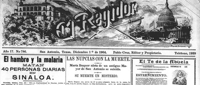
One of these unique titles is Revista Del Valle, a daily Spanish-language newspaper published in Edinburg, Texas, the county seat of Hidalgo County in southern Texas. A brief but historically-significant collection of issues of Revista Del Valle from the year 1915 is now available on the Portal. According to the Texas State Historical Association’s Handbook of Texas Online, 1915 was the year that the arrival of irrigation transformed the region from a ranching community to the major agricultural region that it is today. The importance of farming in the region is reflected in Revista Del Valle’s ornate masthead. However, much of the reporting in these issues is devoted to the “Borderlands War” conflict, an undeclared period of conflict along the Texas-Mexico border that coincided with the Mexican Revolution, which is often overshadowed by World War I in the historical record. As the railroad brought more settlers to the region, landowners of Mexican descent were often displaced “using unscrupulous and often illegal tactics”. This led to resentment, racial tension, and ultimately extreme violence on both sides. This editorial from May 11, 1915 illustrates the urgency of a region and a world in conflict and advises against participation in future wars.

The Oklasodak, another unique title in the Borderlands collection, is a 1916-1917 “newspaper of the soldiers, for the soldiers, and by the soldiers” published by National Guardsmen from the states of Louisiana, South Dakota, and Oklahoma. Perhaps in response to the unrest along the border, the troops were stationed in San Benito, Texas under the leadership of Colonel Robert Lee Bullard, and eventually were called the Bullard’s Brigade. The newspaper was first published on August 25, 1916, and ran until February 7, 1917. The last edition stated its early and abrupt suspension due to an order for the soldiers to return to their respective homes. In the 24 published issues of the regimental newspaper, many segments include geographical and social challenges of life in a border town. The reoccurring segments, “Life of the Soldier” and “Health of the Soldier,” provided general advice to these challenges.

In one of the “Health of the Soldier” segments from the November 8, 1916 issue, Captain W. S. Shields, the camp sanitary investigator, informs the soldiers about the harmful–and often deadly–illnesses of the native population of Tampico, Mexico, including malaria and tuberculosis. In the January 3, 1917 issue, the article, “Mexican Vote Puts Town Wet,” shows some of the clashing interests or ideologies of the American soldiers and the Mexican citizens during the period. The American soldiers desired a dry city to practice obedience, attention, and initiative. However, the wet vote beat the dry vote 265 to 215.

The Oklasodak is a great addition to the Texas Borderlands Newspaper Collection. It shows a brief moment in history of the daily life in borderland and provides insight into the lives of American soldiers in the early 20th century.

Texas State Library and Archives Commission Logo Institute of Museum and Library Services Logo Texas Digital Newspaper Program Collection Logo