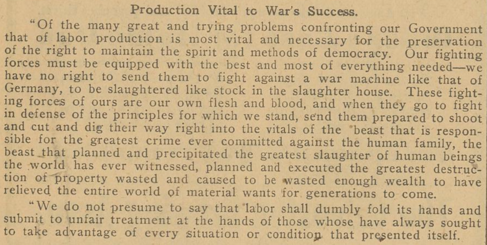
This week, the TDNP collection hit 9 million pages of newspapers preserved. Keep reading to get a sense of what this milestone means in newspaper issues and collection highlights.
The Numbers
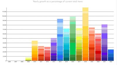
The image below displays the newspaper issues uploaded each year. Since this tracks newspaper issues, rather than page count, a lower bar in a year does not necessarily indicate fewer pages uploaded.
Why do we talk about pages? When the National Digital Newspaper Program was established, newspaper digitization was measured according to pages per microfilm reel. As such, NDNP led the country in determining page measurement versus issue measurement as being a guiding figure for project costs and completion. As a result and given the inconsistencies in issue size, the Texas Digital Newspaper Program also tracks pages as the key component for measuring project completion and collection size. This way, the TDNP staff will complete a project consistently by page count, rather than having to aim at a moving target of issue or year count–because a year of a daily newspaper contains 6x more issues than a year of a weekly newspaper!
How many issues are in the TDNP collection? Every collection on the Portal (as well as on the Gateway to Oklahoma History and the UNT Digital Library) has a statistics page, linked in the left-hand column next to the collection description. These statistics pages show “items,” and each item equals a newspaper issue, while a “file” is an actual newspaper page. This is a dynamic page that changes as we add more content. Thus, at the time of this writing, the TDNP collection hosts:
|
|
865,236 |
Total Items (Newspapers) |
|
|
9,012,757 |
Total Files (Newspaper pages) |
In addition, the statistics page tracks collection “usage.” For the Portal, the “usage” refers to actual interactions with a newspaper issue, versus page hits. Thus far, TDNP has a usage count of just over 40.5 million, since 2009.
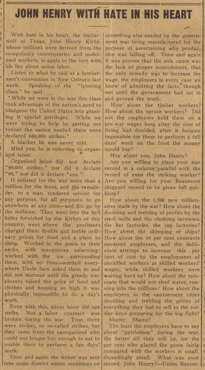
Staff Picks
As we work on the newspaper collection, my staff and I regularly come across interesting, unique, or strange titles, mastheads, or articles. To celebrate the 9 millionth page this year, the four of us chose favorite newspapers we uploaded in this past million-page set.
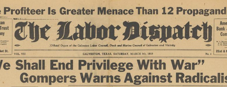
From Sarah Lynn Fisher, our project coordinator for the National Digital Newspaper Program for Texas and for the Gateway to Oklahoma History, we have her favorite masthead, from the Brownsville Herald. This masthead displays all the cities where the Herald circulated, mostly in Cameron and Hidalgo Counties.

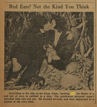
From Brooke Edsall, our large-format imaging manager, we have the Silsbee Bee, which is her favorite thanks to the very cute content she regularly encountered as she scanned it. The article to the left is just one example of sweet snippets Brooke and her team found as they worked with the Silsbee Bee.
The pick of Tim Gieringer, our metadata coordinator for TDNP, is the NT Daily collection, which we digitized in partnership with our Special Collections Department. Tim said he has loved reading through these newspaper pages to learn more about UNT’s history.

My own favorite from this million page set is a Spanish-language newspaper from San Diego, Texas, and it was donated to us by a huge Portal to Texas History fan. He and his family were going through his father’s garage and found this issue of El Democrata from January 1940. We never know what treasures people may find in their attics and garages, and we’re always excited to take them in!
Our favorites change almost daily, so if your favorite newspaper wasn’t mentioned above, have no fear: We really do love all the newspapers we upload!
Special Thanks to Everyone
The team of people who make this work so special includes the full-timers mentioned above, as well as a group of talented student assistants, without whose work none of these 9 million pages would have been possible. In addition, we are grateful to the support we have received from the National Endowment for the Humanities; the Texas State Library & Archives Commission’s TexTreasures support through Institute of Museum & Library Services LSTA funding; the Tocker Foundation; and the Hancher Foundation. Finally, we thank our publishers and partners for their generosity and trust in sharing their collections with us to preserve their community newspapers and make them available to the world. We are proud to support our patrons in their quest for knowledge as they research the newspaper collections, and we are grateful to everyone who has helped us build TDNP into such a terrific resource.
 Did you know you can browse the Texas Digital Newspaper Collection (and any collection on